
Logbook Entry 1 - Down the Chesapeake Bay and Onward
- Dec 1, 2017
- 4 min read
TOTAL MILES TRAVELED ON SAIL to SEE EXPEDITION: 400 NM (Nautical Miles)

THE LAST PASSAGE
Miles traveled using SAILS – WIND POWER ONLY: 240 NM
Miles traveled using both SAILS & ENGINES together: 96 NM
Miles traveled using ENGINES – FOSSIL FUELS ONLY: 64 NM
Average Water Temperature: 58 f/14 c
Average Air Temperature: 38 f/3 c
Strongest Wind : 36 Knots (knots are a wind measurement of Nautical Miles per hour)
Animal Sightings:
Chesapeake Bay: Brown Pelicans, Northern Gannets, Dolphins
A 30’ Right Whale was reported to be near York Spit
Atlantic Ocean: Dolphins, Northern Gannet, Green Sea Turtle
Plastics Collection: Towing for plastics with a trawl to begin soon - stay tuned.
VOS Reports Filed : VOS weather reports to begin soon - stay tuned.

Elcie has departed from Oxford, Maryland and has completed the first 400 nautical miles of her Around the World Voyage. The crew is very excited to share their voyage with you. Just so you know, on a boat, we count our miles by the term nautical mile.
What is a nautical mile?
A nautical mile is based on the circumference of the planet Earth. If you were to cut the Earth in half at the equator, you could pick up one of the halves and look at the equator as a circle. You could divide that circle into 360 degrees. You could then divide a degree into 60 minutes. A minute of arc on the planet Earth is 1 nautical mile. This unit of measurement is used by all nations for air and sea travel.
The first leg on Elcie took her down the Chesapeake Bay and around Cape Hatteras to Beaufort, NC. The

Chesapeake Bay in November can be very cold and windy. All the crew layered up for working outside. The sails have to be put up and down even in the cold if you want to use the wind for power instead of the engines.

There is no heat on Elcie so to keep warm we had to dress warm all the time. We did have a few clay flowerpots upturned on the gas stove for a little extra heat in the galley however you had to be closer than three feet to feel the warmth.

Our first stop was in Bivalve, MD on the Nanticoke River. We tied up in a small marina and visited an Organic Farm that belongs to a friend. We are making a short video about our visit to Provident Farm and will post it as soon as it it ready. Farmer Jay gave us some insight about how farming practices need to be adapted to the weather extremes we will face with climate change.
We sailed very close to Tangier Island in Virginia. Unfortunately, with the changing weather conditions, we were not able to stop. We were able to see how many houses are on this tiny island of 650 residents. The houses look like they are just a few feet above sea level. It’s very possible that the residents of Tangier Island will have to move one day because of the threat of sea level rise.

There was a fair amount of boat traffic on the Chesapeake in November. Can you figure out which boat is which from the list below (there are not photos of all of them):


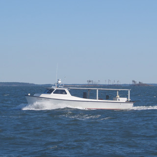


Dawn Treader – Recreational Powerboat in the Choptank River
Maritime Trader – Tanker northbound in Chesapeake to Baltimore
Elizabeth – Barge of sand being pushed by a tug south of Fishing Bay
Oyster Boats – Dredging for oysters south of the Nanticoke RiverCharter
Fishing Boat out of Deal Island
Mail Boat to Tangier Island
A Crab Boat tending pots in the Choptank River
Drew Frank - USCG Buoy Tender

We spotted a sun dog, formally called a parhelion in meteorology. It is an atmospheric optical phenomenon that consists of a bright spot to the left and/or right of the Sun. It is said to forecast rain to come in about 36 hours. We found it to be true. Can you spot the sun dog in this photo?

There is always a lot to learn on a boat. In this photo, the mate is teaching one of the crew how to tie a bowline knot in the end of a dock line. There is a short video with instructions on how to tie a bowline on the homeport page. You can try and learn how to tie one too.

Work on the boat sometimes requires going up the rig to do work. We wear a safety harness and clip in to prevent falls when going aloft. There are many jobs to be done on a boat to keep it running smoothly. On a boat, one has to be a plumber, an electrician, a mechanic, a cook and a medic too.

We sailed overnight around the Outer Banks of Virginia and North Carolina and arrived in Beaufort, NC at sunset on the following day. We anchored very close to the Cape Lookout lighthouse. In Beaufort we had our Thanksgiving dinner. We also went to the store to buy more fresh food for the 550 NM trip south to the Bahamas.
We hope you will keep checking in on Elcie's journey around the world! The Leg 2 Logbook Entry will be posted on December 15th.
WHERE WE VISITED:
Official Name: Bivalve, MD
Government: Unincorporated Community
County: Wicomico
State: Maryland
Country: United States of America
Population: 201 (2010)
Area: 1.349 sq mi (3.49 km2)
Currency: U.S dollar
Language: English
Highest Point: 13ft.(4m) above sea level
Climate: temperate
Natural Hazards: flooding, erosion, drought
Primary Industry: farming, fishing
Interesting Fact: Bivalve takes its name from the oyster, upon which the town's economy once depended. The high ground in Bivalve is thought to be the remains of native American shell middens. This is where native American tribes discarded oyster shells after eating the contents.
County Flag:

State Flag:

Country Flag:

Comments