
Logbook Entry 24 - Turks and Caicos - Bahamas and Closing the Loop!
- Apr 27, 2019
- 5 min read

TOTAL MILES TRAVELED ON SAIL to SEE EXPEDITION:
30,833
THE LAST PASSAGE
Total Miles traveled on last passage – 279 NM
Miles traveled using SAILS – WIND POWER ONLY: 109 NM
Miles traveled using both SAILS & ENGINES together: 146NM
Miles traveled using ENGINES – FOSSIL FUELS ONLY: 24NM
Animal Sightings in Atlantic Ocean and Bahamas: Nurse Sharks, Hawksbill Turtles, Osprey, Dolphins, Dorado Fish, Skipjack Tuna, Blueheads, Butterfly Fish, Barracuda
Strongest Wind:18 Knots (knots are a wind measurement of Nautical Miles per hour)

Ship Sightings: Many, many sailing boats and cruise ships as well as a few container ships.
(The photo on the right shows just how many sail and power boats were around us at one time in the Exuma Islands. Each green line represents the course of a boat. This is a photo of the screen on our computer that uses an AIS to show and identify ships.)
WHAT IS AN AIS? The automatic identification system (AIS) is an automatic tracking system that uses transponders on ships and is used by vessel traffic services (VTS).
PASSAGE NOTES:
The anchorage at Mayaguana was behind a long reef. It was very shallow and we were able to dive and pick up about 100 sand dollars from the bottom.For this leg of the trip, we are crew of 7. Elena's brother, Tim joined us from Germany and Kim who sailed with us earlier in the trip came back for another leg. We sailed about 50 miles from the Turks and Caicos to Mayaguana in The Bahamas on single day. We are so used to sailing at night that it was nice to be able to sail from one country to the next during a single day.


From Mayaguana we sailed during another day to the Plana Cays, two uninhabited islands. Emma and Tim built a tower with a piece of driftwood that we could see for a long distance. We sailed on further to Conception Island, another uninhabited island that is a protected park. We went for a hike along the ocean side of the island. One small bay had trapped tons of Sargassum Weed. We've noticed so much Sargassum weed this year - much more than normal.


Years ago, when we were on Conception Island, we saw so much trash. It looked just like the picture below on the left. Some people from some of the boats got together and picked up all the trash and put it in a pile to be taken away. Some of the trash comes from fishing boats and some comes from trash that has washed or blown into the sea.


Now, Conception Island beach looks like the photo above. It is so much more beautiful without all of the plastic trash on it. It is also much better for sea turtles that need to come on the beach and dig nests in the sand. If there is lots of trash and debris on the beach, they can't find a clear area to bury their eggs.
We sailed another day to Georgetown on Great Exuma. It was very exciting to arrive in Georgetown because this is where we finished our circumnavigation by returning to somewhere we visited on our way out to sail around the world. For sailors, completing a circumnavigation is called Closing the Loop.


Emma made a young friend in Georgetown at the restaurant where we celebrated Closing the Loop. She showed her some photos of places we had visited.
One of our favorite things about the Bahamas is the turquoise color and clarity of the water. Many times we can see our own shadow on the bottom while we are sailing.


Why is the water of the Bahamas so blue?
The waters around the Bahamas are light blue because the water is shallow. The blue color comes from the absorption of red and green light wavelengths by the water. The blue is reflected to be received by your eyes. The light blue is a response to sunlight reflecting off the sand and corals on the bottom. You can sometimes gauge the depth of the water by the lightness or darkness of the blue waters.


Sometimes we find art on the beach made by nature, like this tree or made by humans, like this peace sign.


Emma found a conch shell that she wanted to make into a horn to blow. She and Richard cut off the top of the shell with a saw. You can see she was a bit nervous holding the shell while it was cut with a power tool.
They had to smooth out the hole on top. The shell horn really works! You have to blow into the shell like you would blow into a trumpet.


We hiked up to a monument on a hill on Stocking Island near Georgetown. It is one of the highest points in The Bahamas and has a good view of the water and boats below. Most of The Bahamas are very flat.
Below is a store on Little Farmer's Cay, one of the small islands we visited. This is where the people who live on the island do most of their shopping. It just has very basic foods like rice, beans, oil, flour and salt. Can you imagine if you had to buy all of your food in a store this small? Think about how this store compares to where your parents shop for your family's food.


We went to visit an artist named J.R. that we met when we were in Little Farmer's Cay 17 months earlier. Since the last time we were here, he started making carvings of fish. The middle photos shows all of the wood that was whittled away to make his carvings.


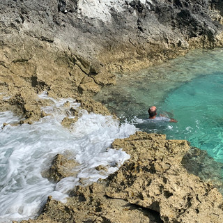
We stopped at Rachel's Bubble Bath. It is a pool that gets all fizzy and foamy when waves wash over the top and into the calm side. It is best to go at high tide when the waves are coming over the gap and into the pool.


We went to see the famous Swimming Pigs a second time too!


Molly had a friend visit from home and they had some exciting adventures together. One adventure was to climb Bell Rock. Can you find Molly and her friend Bree on the rocks? They blend in well against the background.
There are 22 types of lizards in The Bahamas including these curly-tailed lizards we saw on many islands.
We saw some other animals as well including this osprey that wanted to sit on the wind vane at the top of our mast, nurse sharks that will come up to be petted near a fish cleaning station and the pigs of course.


Here is an artistic display of tropical fruits - papaya, melon and grapefruit.
We've really enjoyed being back in the Bahamas. It's time to start thinking about heading north to the Chesapeake Bay again and everyone is looking forward to being home and seeing friends. Making preparations for the last part of our voyage has kept us busy for a few days now.
Stay tuned for our last entry in a couple of weeks!
WHERE WE VISITED: BAHAMAS
Other Names: Commonwealth of the Bahamas
Population: 357,000
Area: 5,382 Sq Miles / 13,939 Sq Km
Capital: Nassau
Type of Government: Unitary Parliamentary Constitutional Monarchy, Achieved independence from the United Kingdom in 1973
Currency: Bahamian Dollar
Languages: English, Bahamian Creole
Religion: Christianity (Baptist, Anglican, Roman Catholic)
Highest Point: Mount Alvernia at 207 Feet / 63 Meters
Climate: Tropical Marine, moderated by the Gulf Stream Current
Natural Resources: salt, aragonite, timber, arable land
Major Exports: fish and crawfish, rum, salt, chemicals, fruits and vegetables
Natural Hazards: hurricanes, tropical storms
Country Flag:

Interesting Facts: The name Bahamas comes from the Spanish, Baha Mar, which means shallow sea. There are around 700 islands in the Bahamas. The Bahamas, known for its crystal clear blue seas, lays claim to the clearest waters in the world, with visibility down to around 200 feet.
It snowed in Freeport in the Bahamas on January 19, 1977 when a cold wave came off the United States.
Comments